
Where is Philippines located on the world map?
The Philippines is an archipelago located in Asia in the western Pacific Ocean. Covering approximately 300,000 square kilometers, the country ranks 73rd in the world in terms of land area.
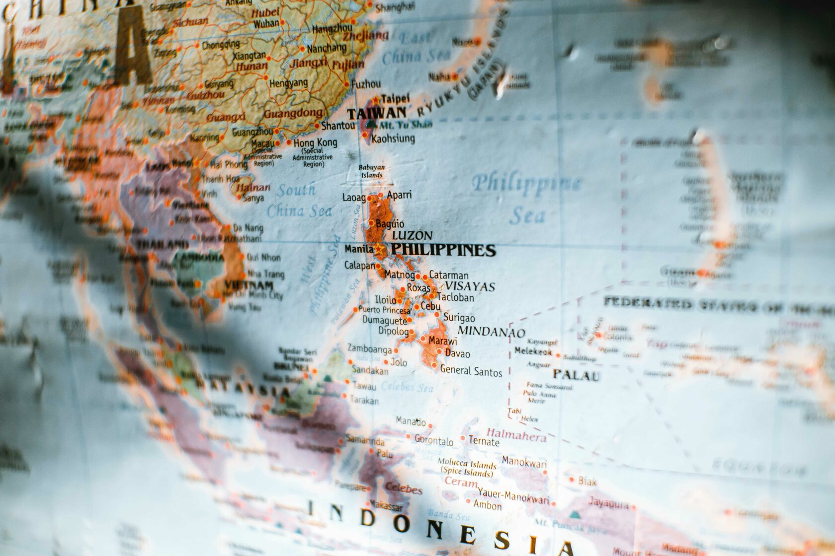
Where is Philippines located in Asia?
The Philippines is located in Southeast Asia. The country is geographically positioned to the east of Vietnam, north of Indonesia, and south of Taiwan. Its exact coordinates are approximately 13.41° N latitude and 122.56° E longitude.
Is Philippines a state country?
The Philippines is an independent nation. It operates as a unitary presidential republic with a democratic form of governance. Having achieved independence from the United States on July 4, 1946, the country possesses its own constitution, government, and political structure.
How many islands in the Philippines?
The Philippines is an archipelago consisting of 7,641 islands during the last official count by the National Mapping and Resource Information Authority (NAMRIA) in 2016. However, the exact number of islands can vary slightly depending on tidal conditions and other factors. It's worth noting that not all of these islands are inhabited, and the count may change due to natural processes such as erosion and accretion.
Where is the part of the Philippines to avoid?
Travel to the provinces of the Sulu Archipelago, including Basilan, Sulu, and Tawi-Tawi, is strongly discouraged due to the presence of extremist groups, a significant threat of attacks, kidnapping, piracy, and violent clashes between security forces and rebel groups.
Similarly, it is advised to avoid all travel to several provinces in western and central Mindanao, including those in the Bangsamoro Autonomous Region in Muslim Mindanao, Lanao del Sur, Maguindanao, Northern Mindanao, Bukidnon, Camiguin, Lanao del Norte, Misamis Occidental, Misamis Oriental, Soccsksargen, Cotabato, Sarangani, South Cotabato, Sultan Kudarat, Zamboanga Peninsula, Zamboanga del Norte, Zamboanga del Sur, and Zamboanga Sibugay. This caution is due to the serious threats of terrorism, kidnapping, high levels of crime, and violent confrontations between security forces and rebel groups.
Similarly, it is advised to avoid all travel to several provinces in western and central Mindanao, including those in the Bangsamoro Autonomous Region in Muslim Mindanao, Lanao del Sur, Maguindanao, Northern Mindanao, Bukidnon, Camiguin, Lanao del Norte, Misamis Occidental, Misamis Oriental, Soccsksargen, Cotabato, Sarangani, South Cotabato, Sultan Kudarat, Zamboanga Peninsula, Zamboanga del Norte, Zamboanga del Sur, and Zamboanga Sibugay. This caution is due to the serious threats of terrorism, kidnapping, high levels of crime, and violent confrontations between security forces and rebel groups.
Where is Cebu City in the Philippines?
Cebu City spans an area of 315 square kilometers (122 sq mi). Positioned to the northeast are Mandaue City and the town of Consolacion, while to the west lie Toledo City and the towns of Balamban and Asturias. To the south, one finds Talisay City and the town of Minglanilla.
On the eastern side, Mactan Island, home to Lapu-Lapu, is situated across Mactan Strait. Farther east, beyond the Cebu Strait, is the island of Bohol.
On the eastern side, Mactan Island, home to Lapu-Lapu, is situated across Mactan Strait. Farther east, beyond the Cebu Strait, is the island of Bohol.
Where is Boracay located in the Philippines?
Boracay Island is positioned 0.8 kilometers (0.50 mi) off the northwest corner of mainland Panay and falls within the jurisdiction of the province of Aklan in the Western Visayas region (Region VI) of the Philippines. It is situated 50 kilometers (31 mi) northwest of Kalibo, the provincial capital; 150 kilometres (93 mi) northwest of Iloilo City, the regional capital; and 200 nautical miles (370 km) southeast of Manila, the national capital. The island takes on a dog-bone shape, stretching approximately seven kilometers in length, with its narrowest point measuring less than one kilometer. The total land area of Boracay is 10.32 square kilometers (3.98 sq mi).
Where is Lucena City in the Philippines?
Situated 130 kilometers (81 mi) to the south of Manila, Lucena City is strategically positioned between two rivers, with Dumacaa River to the east and Iyam River to the west. The city benefits from the natural drainage provided by seven rivers and six creeks. Its port along Tayabas Bay serves as a hub for various boat and ferry lines connecting Lucena to different points within the region and extending as far as the Visayas.
Lucena also features a defunct Lucena Airport (locally known as Landing), positioned 300 meters (980 ft) west of AMA College Lucena Campus. Unfortunately, this airport is no longer operational, with light aircraft unable to use it due to the construction of a road as an intersection during the presidency of Gloria Macapagal Arroyo.
As the provincial capital and former Government Center of the Southern Tagalog Region, Lucena plays host to numerous branches of governmental agencies, businesses, banks, and service facilities, making it a focal point for the Southern Tagalog region.
Where is Palawan located in the Philippines?
The province is comprised primarily of the elongated and narrow Palawan Island, accompanied by a multitude of smaller islands, totaling around 1,780 islands and islets. Positioned to the northeast, the Calamianes Group of Islands includes Busuanga, Coron, Culion, and Linapacan islands. Balabac Island lies off the southern tip, separated from Borneo by the Balabac Strait. Additionally, Palawan encompasses the Cuyo Islands situated in the Sulu Sea. The contested Spratly Islands, located a few hundred kilometers to the west, are recognized by the Philippines as part of Palawan and are locally referred to as the "Kalayaan Group of Islands."
