

Geography of the Bahamas
The Bahamas is an archipelago located between 20 and 27°N latitude and 72 and 79°W longitude. It's separated from the North American Continent by the Florida Channel and is influenced by the cooling effect of the northeast trade winds during the summer. The country extends over 100,000 square miles of sea, with a bit less than half falling within the Tropics. Despite common misconceptions, the Bahamas is situated in the Atlantic Ocean, not the Caribbean.
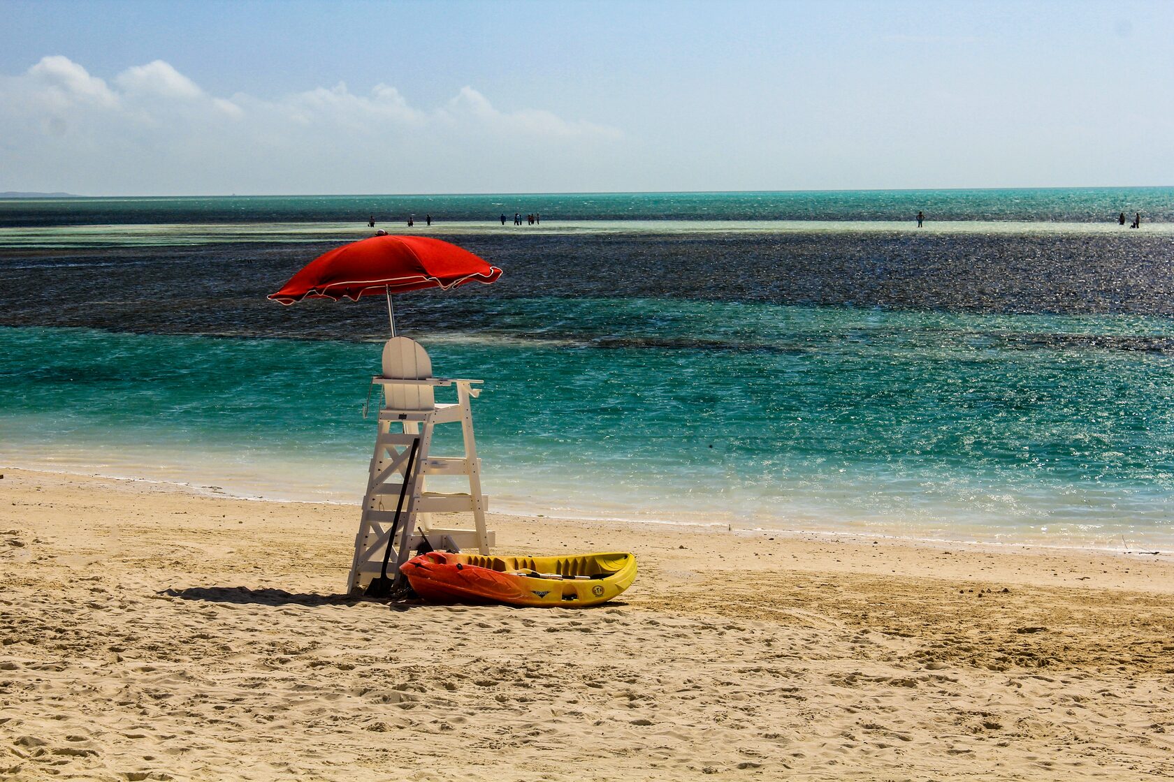
This island nation stretches approximately 760 miles from northwest to southeast and encompasses 30 inhabited islands, 661 cays, and about 2,387 exposed reefs. The total land area is around 5,380 square miles, comparable to the size of Wales or two-thirds the size of Massachusetts. Andros is the largest island, spanning 2,300 square miles, while the smallest inhabited island is Spanish Wells, covering only half a square mile. The highest point is Como Hill on Cat Island, reaching 206 feet. The Bahamas is renowned for its stunning beaches and lagoons.
This island nation stretches approximately 760 miles from northwest to southeast and encompasses 30 inhabited islands, 661 cays, and about 2,387 exposed reefs. The total land area is around 5,380 square miles, comparable to the size of Wales or two-thirds the size of Massachusetts. Andros is the largest island, spanning 2,300 square miles, while the smallest inhabited island is Spanish Wells, covering only half a square mile. The highest point is Como Hill on Cat Island, reaching 206 feet. The Bahamas is renowned for its stunning beaches and lagoons.
Climate of the Bahamas
In terms of climate, the Bahamas experiences no extreme seasonal changes that necessitate winter clothing or central heating. The rainy season lasts from May to October, with Nassau experiencing an average of six inches of rainfall per month during this period. From November to April, the average monthly rainfall decreases to two inches. The hurricane season runs from June through November, with the highest risk in August, September, and October.
During the winter, temperatures rarely dip below 60°F and usually rise to around 77°F by mid-afternoon. In the summer, daytime temperatures range from 85–90°F, dropping to 75°F or less in the evening. Although humidity can reach approximately 80%, prevailing easterly winds help alleviate personal discomfort. Temperature fluctuations occur throughout the year, with the lowest at 76.7°F in January and the highest at 89.1°F in August. Humidity can cause mildew on leather and textile products, but central air-conditioning or dehumidifiers in homes mitigate these effects.
Rainfall often comes in the form of intense showers, frequently accompanied by strong, gusty winds. These storms are typically short-lived and followed by clear skies. Weather conditions can change rapidly, and statistically, a hurricane can be expected to impact some part of the Bahamas approximately every nine years.
The largest 3 cities of Bahamas
- Nassau: Population: 238,132 (on New Providence)
- Freeport: Population: 47,085 (on Grand Bahama)
- West End: Population: 13,004 (on Grand Bahama)
Other cities of the Bahamas
- Coopers Town: 9,069 (on Abaco)
- Marsh Harbour: 5,728 (on Abaco)
- Freetown: 4,222 (on New Providence)
- Bahamas City: 3,827 (on Grand Bahama)
- Andros Town: 2,318 (on Andros)
- Clarence Town: 1,705 (on Long Island)
- Dunmore Town: 1,578 (on Eleuthera)
- Rock Sound: 1,447 (on Eleuthera)
- Arthur's Town: 1,216 (on Cat Island)
- Cockburn Town: 1,045 (on San Salvador)
- George Town: 1,038 (on Exuma and Cays)
- Alice Town: 936 (on Biminis)
- Sweeting Cay: 494 (on Grand Bahama)
- Matthew Town: 435 (on Inagua Islands)
- Snug Corner: 402 (on Acklins Island)
- Great Harbour Cay: 383 (on Berry Islands)
- Nicholls Town: 255 (on Andros)
- Colonel Hill: 224 (on Crooked Island)
- Pirates Well: 201 (on Mayaguana)
- Port Nelson: 103 (on Rum Cay)
- Duncan Town: 63 (on Ragged Island)
- Albert Town: 23 (on Crooked Island)
Nassau - Paradise Island
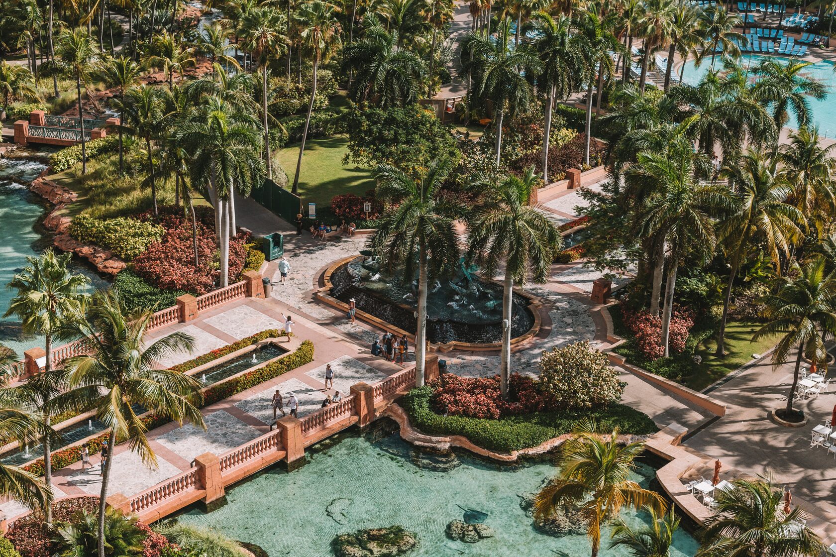
Nassau, pronounced as NASS-aw, serves as the capital and the largest city of The Bahamas. Situated on the island of New Providence, it held a population of 246,329 in 2010, constituting just over 70% of the entire population of The Bahamas. According to the preliminary results of the 2022 census in April 2023, New Providence had a population of 296,522, accounting for 74.26% of the country's population. Nassau is often designated as a primate city, significantly surpassing all other towns in the nation. It functions as the central hub for commerce, education, law, administration, and media within the country.
Freeport
Freeport, situated on the island of Grand Bahama in the northwest Bahamas, is a city, district, and free trade zone. In 1955, Wallace Groves, a financier from Virginia with interests in lumber, was granted 20,000 hectares (50,000 acres) of pineyard, including substantial swamp and scrubland areas, by the Bahamian government. The purpose was to economically develop the area. Over time, Freeport has evolved to become the second most populous city in the Bahamas.
The primary airport serving the city is the Grand Bahama International Airport, handling domestic flights from various Bahamian islands and international flights from the United States, Italy, and Canada. Freeport is also connected through domestic Bahamian ferry services to other islands and an international ferry link to Miami.
The Grand Bahama Port Authority (GBPA) operates the free trade zone, established under the Hawksbill Creek Agreement signed in August 1955. Per this agreement, businesses in the Freeport area were granted tax exemptions until 1980, later extended to 2054. The land area covered by the Hawksbill Creek Agreement has since been expanded to 56,000 hectares (138,000 acres).
West End
West End, also known as "Settlement Point," holds the distinction of being the oldest town and the westernmost settlement on the Bahamian island of Grand Bahama. Contrary to popular belief, it currently serves as the capital of Grand Bahama, overshadowing the misconception that Freeport City holds this title. Furthermore, West End is recognized as the third largest settlement in The Bahamas.
In West End, there is one airport, namely West End Airport, primarily catering to private aircraft. The settlement's dynamics have experienced fluctuations since the 1950s, aligning with the rise and fall of nearby resort developments.
In West End, there is one airport, namely West End Airport, primarily catering to private aircraft. The settlement's dynamics have experienced fluctuations since the 1950s, aligning with the rise and fall of nearby resort developments.
